Christ the Redeemer(statue),Brazil

Christ the Redeemer (Portuguese: Cristo Redentor, standard Brazilian Portuguese: [ˈkɾistu ʁedẽˈtoʁ], local dialect: [ˈkɾiʃtu ɦedẽjˈtoɦ]) is an Art Deco statue of Jesus Christ in Rio de Janeiro, Brazil. It is 30 metres (98 ft) tall, not including its 8-metre (26 ft) pedestal, and its arms stretch 28 metres (92 ft) wide.

The statue weighs 635 tonnes (625 long, 700 short tons), and is located at the peak of the 700-metre (2,300 ft) Corcovado mountain in the Tijuca Forest National Park overlooking the city. A symbol of Brazilian Christianity, the statue has become an icon for Rio de Janeiro and Brazil. It is made of reinforced concrete and soapstone, and was constructed between 1922 and 1931.

The idea of building a large statue atop Corcovado was first suggested in the mid-1850s, when Vincentian priest, Pedro Maria Boss, suggested placing a Christian monument on Mount Corcovado to honour Princess Isabel, princess regent of Brazil and the daughter of Emperor Pedro II; Princess Isabel did not act on this request. In 1889, the country became a republic and, with the official separation of state and church, the idea was dismissed.

The second proposal for a landmark statue on the mountain was made in 1920, by the Catholic Circle of Rio.The group organized an event called Semana do Monumento(“Monument Week”) to attract donations and collect signatures to support the building of the statue. The donations came mostly from Brazilian Catholics. The designs considered for the “Statue of the Christ” included a representation of the Christian cross, a statue of Jesus with a globe in his hands, and a pedestal symbolizing the world. The statue of Christ the Redeemer with open arms, a symbol of peace, was chosen.

Local engineer Heitor da Silva Costa designed the statue; it was sculpted by Polish-French sculptor Paul Landowski.

The face of the statue was created by Romanian sculptor Gheorghe Leonida, who was born in Galati, Romania, in 1893. He studied sculpture at the Fine Arts Conservatory in Bucharest, then, after three more years’ study in Italy, he won a prize for the sculpture Reveil(“Awakening”). After that he moved to Paris, where his work, Le Diable (“The Devil”), was awarded the Grand Prix. Becoming famous in France as portraitist, he was included by Paul Landowski in the team that started working on Christ the Redeemer in 1922. Gheorghe Leonida contributed by portraying Jesus Christ’s face on the statue, which made him famous
         .a03_42346904               christ_the_redeemer_over_rio christ-the-redeemer1                          Christ-the-Redeemer-bright stock-footage-rio-de-janeiro-brazil-march-corcovado-mountain-sunset-rio-de-janeiro-brazil-jesus-christ

Iguazu Falls, Brazil

                                                  iguazu


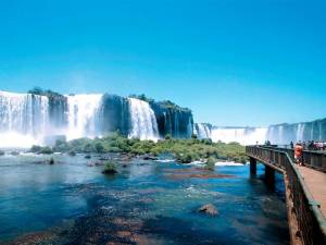
Iguazu Falls, Iguazú Falls, Iguassu Falls, or Iguaçu Falls (Portuguese: Cataratas do Iguaçu [kataˈɾatɐʒ du iɡwaˈsu]; Spanish:Cataratas del Iguazú [kataˈɾatas ðel iɣwaˈsu]; Guarani: Chororo Yguasu [ɕoɾoɾo ɨɣʷasu]) are waterfalls of the Iguazu River on theborder of the Argentina province of Misiones and the Brazilian state of Paraná. The falls divide the river into the upper and lower Iguazu. The Iguazu River rises near the city of Curitiba. For most of its course, the river flows through Brazil, however, most of the falls are on the Argentine side. Below its confluence with the San Antonio River, the Iguazu River forms the boundary between Argentinaand Brazil.

The name “Iguazu” comes from the Guarani or Tupi words “y[ɨ], meaning “water”, and “ûasú[waˈsu], meaning “big”.Legend has it that a deity planned to marry a beautiful woman named Naipí, who fled with her mortal lover Tarobá in a canoe. In a rage, the deity sliced the river, creating the waterfalls and condemning the lovers to an eternal fall. The first European to record the existence of the falls was the Spanish conquistador Álvar Núñez Cabeza de Vaca in 1541.

Iguazu Falls is located where the Iguazu River tumbles over the edge of the Paraná Plateau, 23 kilometres (14 mi) upriver from the Iguazu’s confluence with the Paraná River. Numerous islands along the 2.7-kilometre-long (1.7 mi) edge divide the falls into many separate waterfalls and cataracts, varying between 60 to 82 metres (197 to 269 ft) high. The number of these smaller waterfalls fluctuates from 150 to 300, depending on the water level. Approximately half of the river’s flow falls into a long and narrow chasm called the Devil’s Throat (Garganta del Diablo in Spanish or Garganta do Diabo in Portuguese). The Devil’s Throat is U-shaped, 82 metres high, 150 m wide, and 700 m long (269×492×2,297 ft). Placenames have been given also to many other smaller falls, such as San Martín Falls, Bossetti Falls, and many others.


Iguazú Falls from the Argentine side

About 900 metres (2,950 ft) of the 2.7-kilometre (1.7 mi) length does not have water flowing over it. The edge of the basalt cap recedes by 3 mm (0.1 in) per year. The water of the lower Iguazu collects in a canyon that drains into the Paraná River, a short distance downstream from the Itaipu Dam. The junction of the water flows marks the border between Brazil, Argentina, and Paraguay. There are points in the cities of Foz do Iguaçu, Brazil, Puerto Iguazú, Argentina, and Ciudad del Este, Paraguay, which have access to the Iguazu River, where the borders of all three nations may be seen, a popular tourist attraction for visitors to the three cities.

           Iguazu-Falls PrimaryIguazu-FallsBrazilRio-to-Iguazu-Falls-156311321631339_800_600

Bondi Beach,Sydney

                                    1-jpg

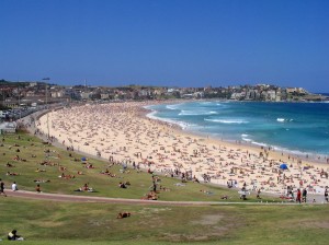
Bondi Beach or Bondi Bay (/ˈbɒnd/ bon-dye) is a popular beach and the name of the surrounding suburb in Sydney, New South Wales, Australia. Bondi Beach is located 7 km (4 mi) east of the Sydney central business district, in the local government area of Waverley Council, in the Eastern Suburbs. Bondi, North Bondi and Bondi Junction are neighbouring suburbs.

“Bondi” or “Boondi” is an Aboriginal word meaning water breaking over rocks or noise of water breaking over rocks. The Australian Museum records that Bondi means place where a flight of nullas took place.

Bondi Beach is about 1 kilometre (0.62 mi) long and receives many visitors throughout the year.

Bondi Beach is the end point of the City to Surf Fun Run which is held each year in August. The race attracts over 63,000 entrants who complete the 14 km run from the central business district of Sydney to Bondi Beach. Other annual activities at Bondi Beach include Flickerfest, Australia’s premier international short film festival in January, World Environment Day  in June, and Sculpture by the Sea in November. In addition to many activities, the Bondi Beach Markets is open every Sunday. Many Irish and British tourists spend Christmas Day at the beach.

Numerous festivals and events such as the annual Miss Bondi beauty pageant have made Bondi Beach a popular destination among travellers. The beach has long captured the attention of poets including Joanne Burns, Les Murray and Brook Emery. The Vans Bowl-A-Rama skateboarding competition is held at the skate bowl in February every year.

images (1)Bondi Gold, at bondi, bondi beach, sydney, nsw, australia, andy soloimages


Great Barrier Reef

                                   SOFT CORAL

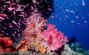
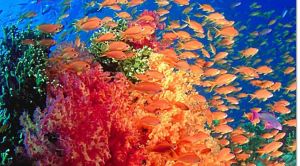
The Great Barrier Reef is the world’s largest coral reef system  composed of over 2,900 individual reefs and 900 islands stretching for over 2,300 kilometres (1,400 mi) over an area of approximately 344,400 square kilometres (133,000 sq mi).The reef is located in the Coral sea, off the coast of Queensland,Australia.

The Great Barrier Reef can be seen from Outer space and is the world’s biggest single structure made by living organisms.This reef structure is composed of and built by billions of tiny organisms, known as coral polyps.It supports a wide diversity of life and was selected as a World Heritage Sites in 1981.CNN labeled it one of the seven natural wonders of the world. The Queensland National Trust named it a state icon of Queensland.

A large part of the reef is protected by the Great Barrier Reef marine park, which helps to limit the impact of human use, such as fishing and tourism.

SOFT CORAL great-barrier-reef (1) great-barrier-reef

Opera House,Sydney


images (2) images (3)


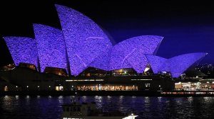
The Sydney Opera House is a multi-venue performing art center in sydney, New South Wales, Australia. Situated on Bennelong Point in Sydney Harbour, close to the Sydney Harbour Bridge, the facility is adjacent to the Sydney central business district and theRoyal Botanic Gardens, between Sydney and Farm Coves.

Designed by Danish architect Jørn Utzon, the facility formally opened on 20 October 1973[3] after a gestation beginning with Utzon’s 1957 selection as winner of an international design competition. The NSW Government, led by Premier Joseph Cahill, authorised work to begin in 1958, with Utzon directing construction. The government’s decision to build Utzon’s design is often overshadowed by circumstances that followed, including cost and scheduling overruns as well as the architect’s ultimate resignation.[4]

Though its name suggests a single venue, the project comprises multiple performance venues which together are among the busiest performing arts centres in the world — hosting over 1,500 performances each year attended by some 1.2 million people. The venues produce and present a wide range of in-house productions and accommodate numerous performing arts companies, including four key resident companies: Opera Australia, The Australian Ballet, the Sydney Theatre Company and the Sydney Symphony Orchestra. As one of the most popular visitor attractions in Australia, more than seven million people visit the site each year, with 300,000 people participating annually in a guided tour of the facility.

images (1)

images

193946-sydney-opera-house

Australian Capital Territory,Canberra

Namadgi National Park in the Australian Alps is a world of natural bushland, breathtaking vistas, abundant native wildlife and rich Aboriginal history, all just 45 minutes drive from Australia’s capital, Canberra.

As you explore the area you’ll discover old campsites with fragments of stone and animal bone left by the Ngunnawal people during the last Ice Age. You can visit the ancient quarry sites where they gathered stone for making tools and even follow the Yankee Hat Walking Track to the rock painting sites of Yankee Hat Shelter. See where Ngunnawal people harvested nut-flavoured Bogong moths in Mount Kelly and the ceremonial stone arrangements in the high peaks of Mount Namadgi are another attraction you simply won’t want to miss.

With over 50 sites of Ngunnawal occupation in Namadgi, a guided tour will help you experience the absolute highlights of the area. In nearby Tidbinbilla Nature Reserve you can travel back in time as you follow the Birrigai Time Trail to the state’s oldest Aboriginal site, the Birrigai Rock Shelter where the local people took shelter from the extreme conditions of the Ice Age. You can also visit Bogong Cave, where tribes gathered to collect Bogong moths which were a tasty food source, and Tidbinbilla Mountain, a sacred initiation site for young Aboriginal men.

The National Gallery of Australia has recently established a dedicated section highlighting the diversity and complexity of Aboriginal and Torres Strait Islander Art. It focuses on the evolution of Aboriginal art and its regional stylistic variations. The National Museum of Australia also features an extensive section showcasing both the traditional and contemporary stories of Aboriginal Australians

my first post

hello ppl…….i m an IT professional who has just started my blog to make u all travel virtually to the best places in the world……….and the best  thing about this tour is ….that …it is absolutely FREE…..FREE….FREE……FREE….FREE….FREE